

Some stats, notes and observations:
- Duration: 7 hours (including a few stops for water, snacks, etc.)
- Distance: 13 miles
- Elevation Gain: 4,200+ feet
- Weather: 47° F at 8am; 75° F at 3pm
- Starting Location: Mitchell Canyon Visitor Center, 96 Mitchell Canyon Road (Clayton)
- Hike (URL): https://www.alltrails.com/trail/us/california/mitchell-rock-mount-diablo-and-north-peak-loop
- Mount Diablo Information: https://www.parks.ca.gov/?page_id=517
- Lunch: BYO.
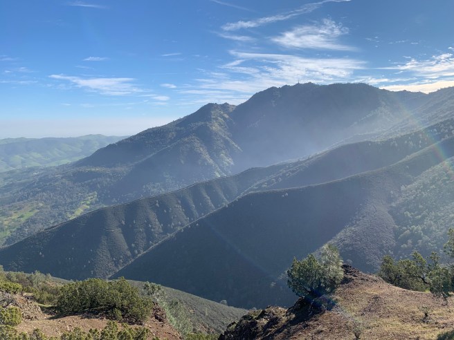
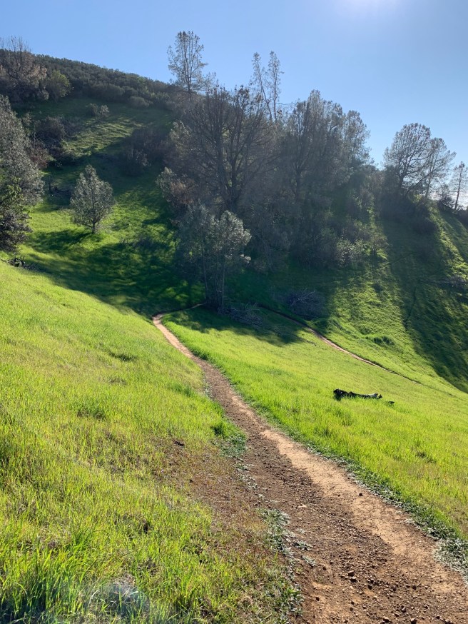
- Notes and Observations: Leave early. Parking lot opens at 8am sharp. Bring $6 (exact change). This one was easy. Not. In the spirit of transparency, I had provided a black box warning to our intrepid hiking crew, so it cannot be said, at least theoretically, that no one knew what this one entailed. I fought the [mountain], and the [mountain] won. Not really, but there were some challenging bits, in part due to my navigation services that in a few, very limited instances (mind you) were less than impeccable, including a near vertical climb early on in the hike, a shortcut, as I characterized it, en route to our first of quite a few stops, Mitchell Rock. This was my second Diablo vision quest in less than one year, the last one in March 2021, with an intrepid crew of 3, including me. Same route, except that we had enough time to summit (3,849 feet), rather than make it most of the way up to North Peak (3,557 feet). Note that the hike in the URL above will take you to both peaks; we decided to forego North (which would have added another two miles and concomitant pain). While it has not rained in the San Francisco Bay Area for 35+ days (ugh), the base of the mountain (580 feet) is surprisingly green and lush. As you ascend, through manzanita mazes and past pine trees with the world’s largest cones (see below), it becomes increasingly arid, although I did espy a stream mid-mountain. Not quite a moonscape, The Silent Sea, but sparse, with haze in all directions, the mountain pleading, if not screaming at times, for precipitation, the Sierra Nevadas visible 100 miles to the east, still snowcapped, providing hope that the situation is not completely dire. Mission Peak, our least hike, was visible as well, to the south, and Mount Hamilton beyond that, visible above the recalcitrant haze. At the top, we enjoyed a brief bagged lunch, refilled out water bottles, and had the obligatory group photo taken of us. 9 hikers started the hike, and 9 had summitted. We stopped at Eagle Rock (2,389 feet) on our descent, just as we did on our ascent, before retracing our steps to Mitchell Rock and finally the parking lot. There are more than a few, mercifully shaded picnic tables right below the lot, with a stream right behind. I brought out the customary apres-ski beverages, aqua vita, including one that had, as I realized the following day, surprising anti-inflammatory qualities. In time, the rest of the crew, besides the first few, joined us, cheered to a solid day’s work, lively conversation, and camaraderie, and indicated, or so it seemed, that despite the travails de jour, they would be open to another hike in the near future. Comments welcomed.


It was a lot of fun. Thank you!
LikeLike
You capture it all! You make me proud.
LikeLike