
Some stats, notes and observations:
- Duration: 5 hours (including a few stops for water, snacks, etc.; and driving time from Hike #1 to Hike #2)
- Distance: 11 miles (10.1 per All Trails)
- Elevation Gain: 1,361 feet (both trails)
- Weather: 50° F at 9am; 70° F at 1pm
- Starting Location – Hike #1: Drakes Head Trail Parking Lot (38.08154, -122.91403)
- Starting Location – Hike #2: Point Reyes Lighthouse Visitor Center Parking Lot (37.99786, -123.01229)
- Hike (URL) #1: https://www.alltrails.com/trail/us/california/drakes-head-trail
- Hike (URL) #2: https://www.alltrails.com/trail/us/california/point-reyes-lighthouse-visitor-center-trail)
- Point Reyes information: https://www.nps.gov/pore/index.htm
- Cypress Tree Tunnel: https://www.nps.gov/places/point_reyes_treetunnel.htm
- Lunch: https://stationhousecafe.com/curbsidemenu/
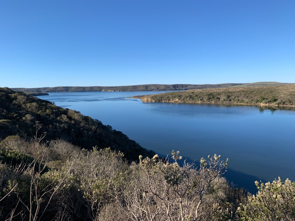
- Notes and Observations: Download the trail map or take a picture at the trailhead. GPS is spotty at best. Leave early. It is 1.5-2 hours door to trail from the mid-Peninsula, but, as illustrated (I hope) below, well worth the schlep. Gorgeous drive, to be sure, but there is simply no easy or quick way to get to Point Reyes (Punto de los Reyes (Point of the Kings)), “discovered” in 1603 by Sebastian Vizcaino, a Spanish explorer. Of course, the Miwok Indians had lived on the estero for several thousand years, but that is a separate discussion. The last road to the first trailhead has only one lane. Be sure to go slow, given the (real) possibility of oncoming (and less scrupulous) traffic. Plus, you will not see grass as green, even in late November, before our true local rainy season, this side of Ireland’s Wild Atlantic Way. Add more than a few cows grazing, ominously close to the road, and you have the makings of either a great photo (see below) or a frantic call to your car insurance agent. The Estero Trail parking lot was empty (but for our crew) at 9am. By noon, when we returned, it was full. Well-worn, but so true: the early bird gets the worm. As always, great conversation abounded, on myriad topics, including the future of education (and the importance of teaching not only new tools, but frameworks for learning tools that do not yet exist and using existing tools in novel ways to solve complex problems), the workplace of the future (as astutely noted by one of my fellow hikers, possibly presenting an even better milieu for entrepreneurs and an even more challenging one for (us) worker bees), streaming options (my current project: Black Mirror), inflation, travel, current events, our next hike, etc.
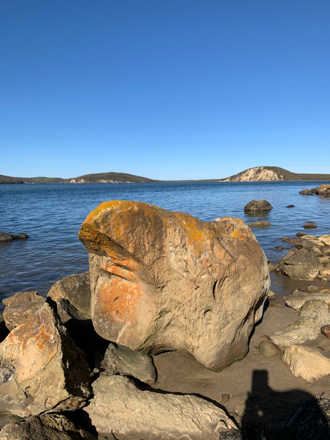
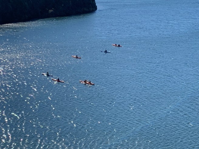
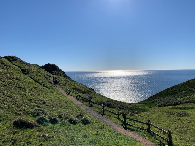
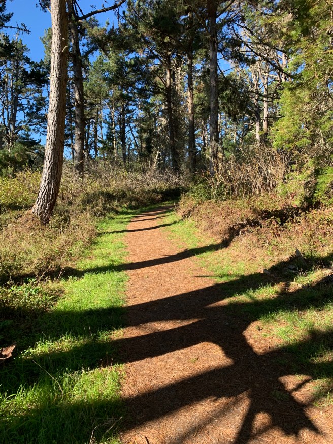
This hike is rated moderate, but easy is more like it, at least compared to some of our hikes in the past few months (Rancho San Antonio, Marin Coastal Trail, etc.). It is, as intimated above, quite picturesque and certainly diverse: rolling hills, the inimitable estuary, a thick grove of pine trees that appears suddenly and shields the hiker from the swirling winds above, the elusive Sunset Beach (hint: you will never find it, as only the trail of the same name exists), sand bars, kayakers enjoying the glistening sun and placid waters, etc. To be sure, we searched for Sunset Beach, continuing along the water well beyond the trail’s terminus, until it was eminently clear that no such beach existed and before too long the tide would come back in, potentially making our adventure truly memorable. Back at our cars, we regrouped and drove to the Point Reyes Lighthouse Trail, past verdant farms, creameries (including Straus), more cows (of course), fleeting dreams of local melted blue cheese atop a perfectly cooked hamburger (apologies to all my vegetarian and vegan readers), cliffs and more cliffs (not quite the Cliffs of Moher, but majestic nonetheless), and the Cypress Tree Tunnel (impressive, but probably not worth the stop). From the lighthouse parking lot, we walked probably less than half a mile until we could see, 300 or so steps below, the lighthouse. It was a perfectly clear late autumn day, with the Farallon Islands and the tops of the towers of the Golden Gate Bridge, 50 miles to the south, clearly visible. Envy the lighthouse keeper I did not; on many, if not most, days, it is pea soup, so foggy you cannot see more than a few feet in front of you. Also, and critically, while the hike down was fine, the climb up, akin to that of 30 story building, was a lung-buster, even for this experienced day-hiking crew.
Next stop, after our hikes, was the quaint little (population 300) town of Point Reyes Station and, of course, the Station House Café. As “leader” of our intrepid crew, I had asked one of our crew members to find a suitable lunch establishment. Unsurprisingly, there was only one requirement: organic grass-fed beef burger with a blue cheese option. Epic, absolutely epic, day. If you’re looking to break the routine, and have an entire day to spend, (seriously) consider the itinerary above.


Thank you for organizing this great adventure.
LikeLike